Strike-Slip Faults: SAFZ - Northern California
EQs & Strike-Slip Faults
Dominant displacement is horizontal and parallel to the strike of the fault. These faults dominate the geology of California. They have been active for 30 m.y. and have 10's to 100's of miles of displacement. Six out of 10 earthquakes occur on these faults. Right lateral strike slip faults are the most common.
Origin of the San Andreas Fault Zone
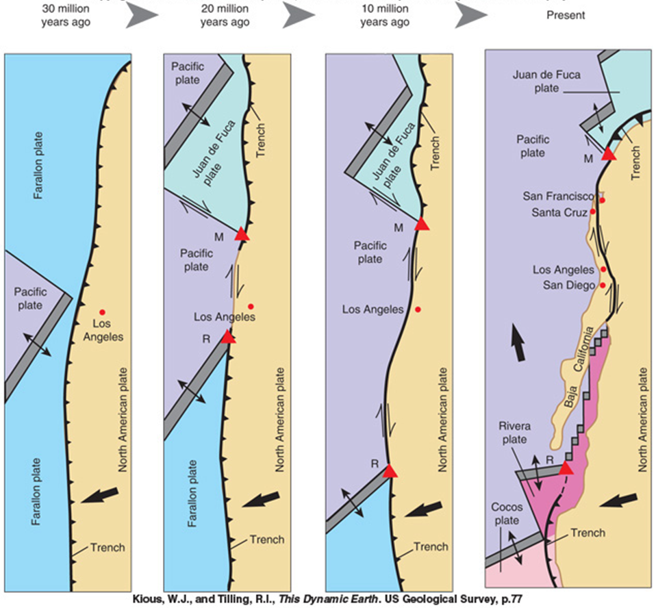
Thirty million years ago or so the Southern California coastline looked much like it does in the Pacific NW today: A spreading center just offshore and a subduction zone inbetween the spreading center and the coast. Around 25 million years ago the subduction zone subducted the spreading center, creating a transform fault we call the San Andreas in between the portions of the spreading center to the north and south that were not subducted. The remnants of the Juan de Fuca plate and the spreading center are still being subducted to the north of us.
|
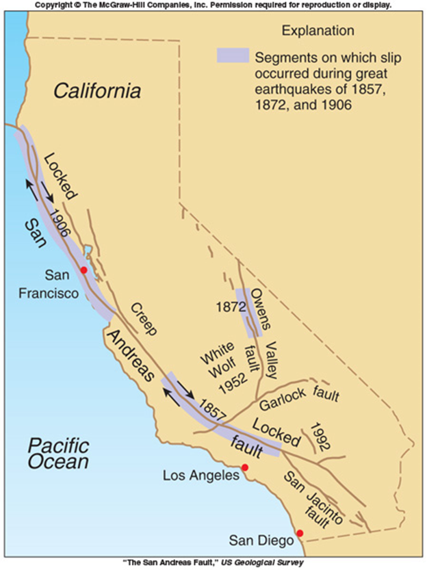
There are three segments of the San Andreas Fault Zone:
|
|
SAFZ – San Francisco Bay Area
The San Andreas Fault Zone is the boundary between the North American and Pacific Plates. Strike-slip faults dominate region due to the stresses produced due to this plate boundary. There are several major faults in the region:
- San Andreas Fault
- Hayward Fault
- Calaveras Fault
- Rodgers Fault
USGS Study: Probabilities of large earthquakes occurring in California on the San Andreas fault
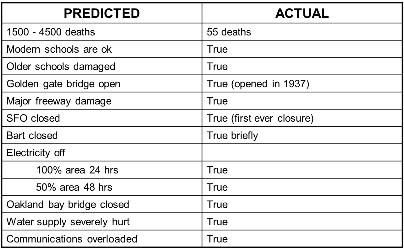
This study, published in 1988, concluded that "...the probability of a major earthquake on the San Andreas in southern California within the next 30 years is high, about 0.6; this probability approaches 0.5 both in the San Francisco Bay Area, and along the San Jacinto fault."
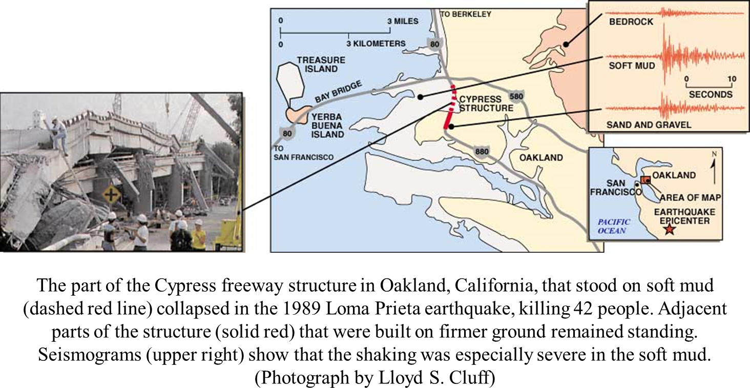
The Loma Prieta Earthquake struck in 1989, one year later, in the area "predicted".
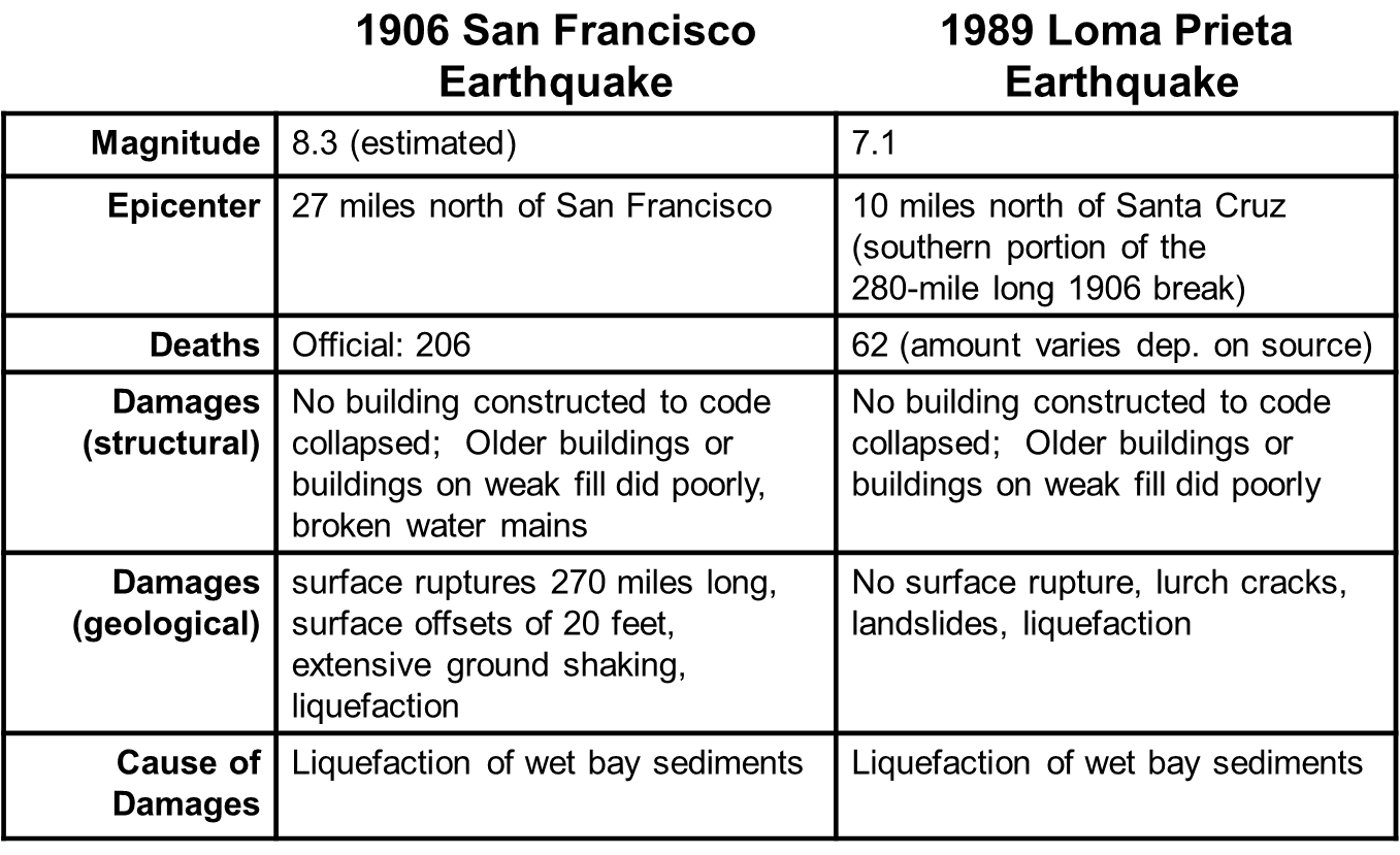
Differences
- Magnitude
- Distance from epicenter
- Amount of surface ruptures
Similarities
- Damages due to liquefaction
- New buildings OK, older buildings failed
Has anything really changed?
Areas of concern:
Soil liquefaction
- Liquefaction is caused by increased pore water pressure
- This is an especially severe problem around the San Francisco bay as large parts of the bay have either:
- Soft, water-saturated natural sediment deposited by rivers
- Soft sandy man-made fills partly from the 1906 earthquake
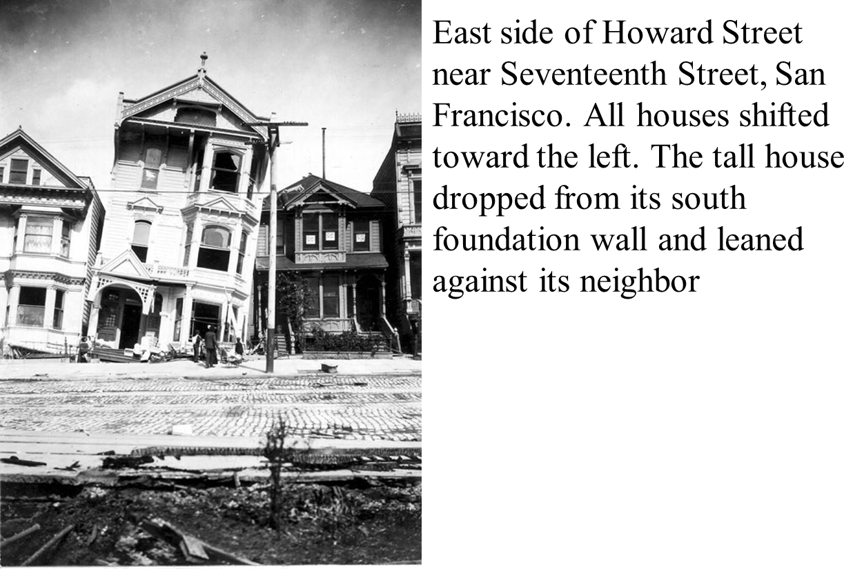
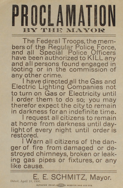
In the late 1980s people started to become interested in genealogy. The city archivist in San Fransisco started to receive lots of phone calls from people wanting information on how their ancestor died during the 1906 earthquake - far more than the official death toll. So she did some digging, and the table below shows her results.

