EQs & Dip-Slip Faults
Normal Faults
- Sierra Nevada fault
- March 27, 1872 Owens valley earthquake
- 8.5 M - California’s greatest
- 29 killed
Cities on normal faults include: Bishop, Reno, Carson City
Thrust faults
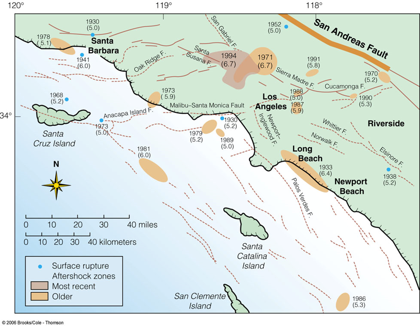
The southern boundary of the transverse range is a series of east trending thrust faults Santa Monica & Sierra Madre fault system. These faults may be characterized by very high horizontal acceleration
Cities on or very near thrust faults – Pasadena, all foothill communities

Blind Thrusts
Blind Thrust faults have no surface expression, so they are typically unknown until an earthquake occurs

Chino EQ - July 29, 2008
|
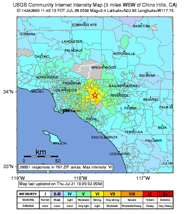
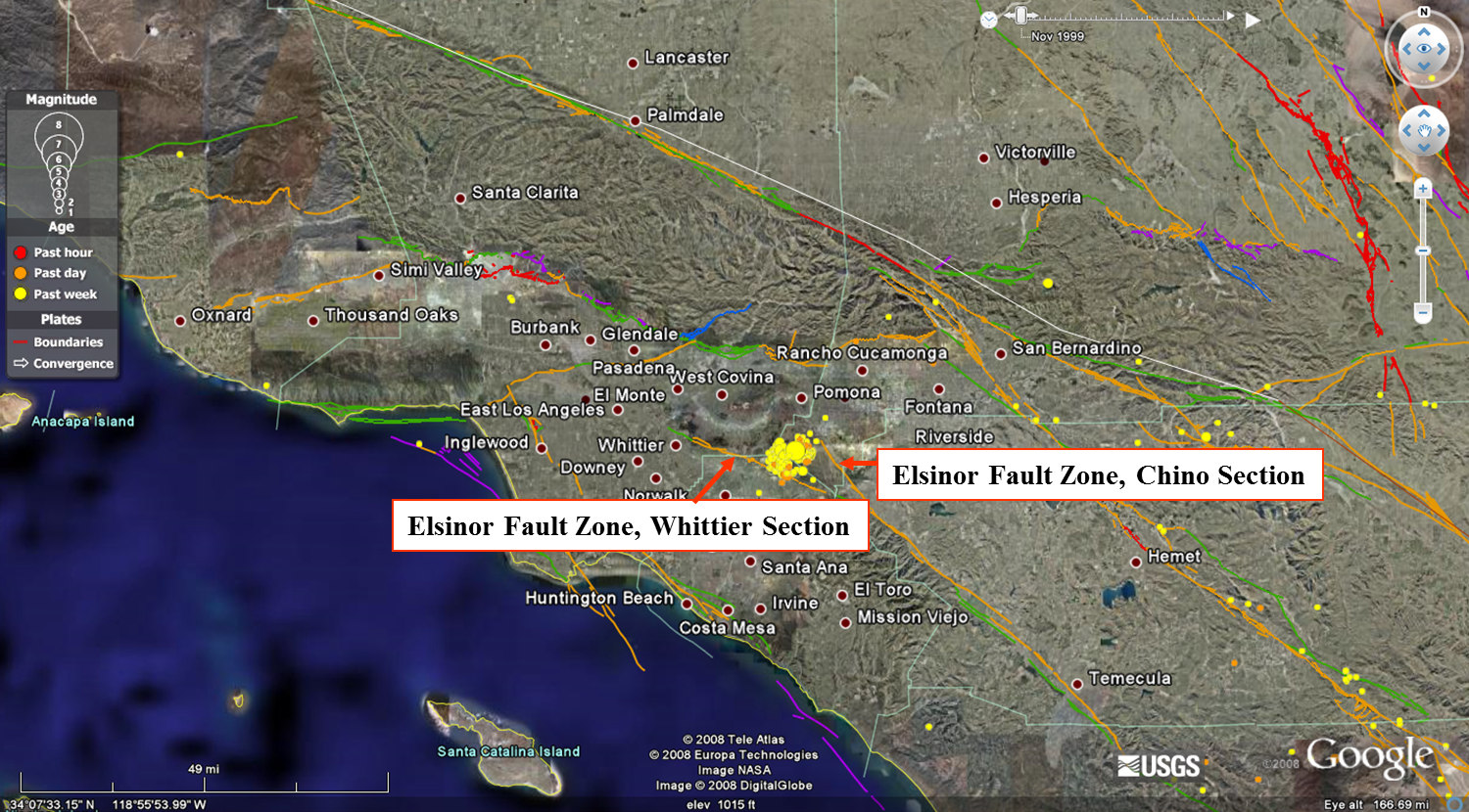
Time: Tuesday, July 29, 2008 at 11:42:15 AM Location: epicenter 4 km (3 miles) WSW from Chino Hills, CA Magnitude: 5.4 Type Of Faulting: a mixture of thrust and left-lateral strike-slip faulting Depth: 9 km Fault: Unknown at this time, but appears to be half-way in between the Whittier and Chino fault |
 |

Below are two seismic intensity maps. The one on the left is a USGS Community Internet Intensity Map, created by the public through the USGS's "Did You Feel It" site. Here, the public can fill out a form describing how strongly they felt the earthquake. This is useful to scientists as humans obviously feel events in ways that sensors can't. The CISN ShakeMap on the right was created by sensors. Sensors are more sensitive to slight movements and variations that human's can't perceive. Thus both types of maps can help seismologists better prepare for the next earthquake.
1971 San Fernando Earthquake
Time: February 9, 1971, 6:01 am PST
Magnitude: Mw 6.6; Intensity: XI
Depth: 8.4 km
Length of shaking: 60 seconds!
Type of faulting: thrust
Fault involved: San Fernando Fault Zone; Minor offset reported on the eastern Santa Susana Fault Zone
Damage
- Over $500 million in property damage
- Several hospitals suffered severe damage
- Newly constructed freeway overpasses also collapsed
- 65 deaths
- Loss of life would have been greater had the EQ struck later in the day.
 |
 |
Results
- Building codes were strengthened
- Alquist Priolo Special Studies Zone Act was passed in 1972.
- The purpose of this act is to prohibit the location of most structures for human occupancy across the traces of active faults and to mitigate thereby the hazard of fault rupture.
- Visit http://www.quake.ca.gov/gmaps/WH/regulatorymaps.htm to find out if your home is in an AP Zone!
1994 Northridge Earthquake
|
Time: January 17, 1994, 4:30:55 Am PST Location: 20 Miles West-northwest of Los Angeles, 1 Mile South-southwest of Northridge Magnitude: Mw 6.7 Type Of Faulting: blind thrust Fault involved: Northridge Thrust Depth: 18.4 Km Duration of shaking: 10-20 seconds
The earthquake significantly deformed the Earth’s crust over an area of about 4,000 square kilometers
|
 |
Damages
- Ground failures of many types at distances up to about 90 kilometers from the epicenter
- Surface Ruptures
- Landsliding
- Soil Liquefaction
Buildings
- Severe damage to buildings, freeways and gas lines due to location
- Thousands of buildings were significantly damaged
- Estimated losses of 15 – 20 billion dollars
Human Death and Injury
- Fifty-seven people died
- +9,000 were injured
- +20,000 were displaced from their homes by the effects of the quake
<< back |
|
next >> |
copyright Sonjia Leyva 2015 |
||

