Features of the Seafloor |
||
Seamounts can form in one of two ways. The first is via a hotspot, and the formation of these types of volcanoes was discussed on the Plate Tectonics: Triple Junctions & Hot Spots page. The second way happens on mid-ocean ridges and rises.
This video describes how mid-ocean ridge seamounts form. As you watch, note the following:
What's the tallest mountain on Earth? If you were to look up that information, the source you would reference would say "Mount Everest" as it stands an impressive 8,850 meters (29,035 feet) high. However, that elevation is above sea level; what about mountains that originate on the seafloor?
The island of New Guinea rises 4,884 meters (16,024 ft) above sea level, and the ocean depths are in excess of 4,000 meters. So Mount Everest has some competition.
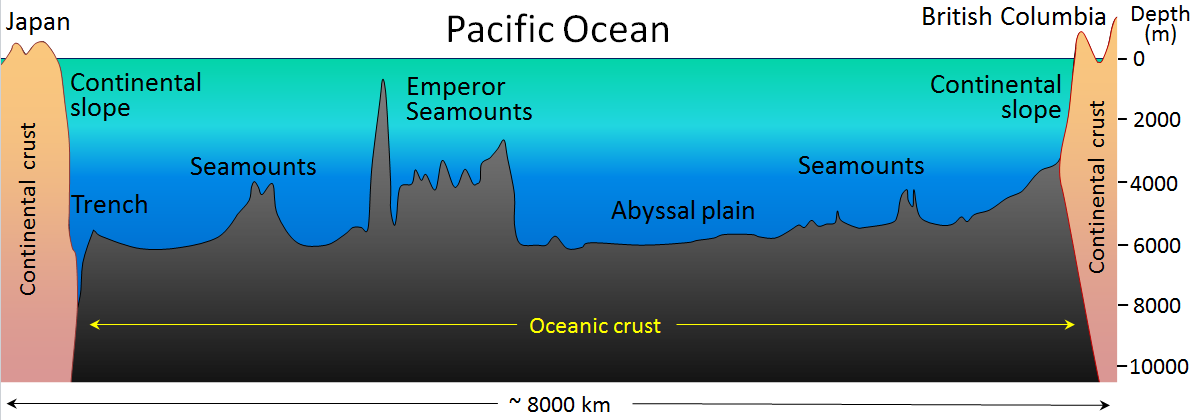
A profile is a cross-section of an area, where the x-axis shows horizontal distance and the y-axis vertical distance at a 1:1 ratio. What this means is that every unit up is the same amount as every unit over (1 foot up =1 foot over). With an exaggerated profile, this ratio is different to show features in greater detail. For the exaggerated profile of the ocean floor shown below, the vertical axis 200 times that of the horizontal to better illustrate the size of the mid-ocean ridge, islands, etc. Note that the Mid-Atlantic Ridge is nearly half the ocean depth as are some seamounts nearby. Now, imagine an island - it has to rise 4,000 meters before it even reaches the ocean surface.
Image source: "generalized-topography-of-the-Pacific-Ocean-sea-floor.png" by Steven Earle, Physical Geology is licensed under CC BY 4.0
copyright Sonjia Leyva 2022 |
|