Earthquakes
What are Earthquakes?
As tectonic plates move around they generate stress. We think of rocks as being hard and brittle but they can actually bend quite a bit before they break. This stress builds up in the rocks over time. An earthquake is the vibration of Earth produced by the rapid release of energy from the build up of all this stress.
Sources of Earthquakes
Earthquakes commonly occur at plate boundaries.
Convergent Plate Boundaries - Subduction Zones & Continental-Continental Collision Zones. The largest earthquakes occur in these areas!
Divergent Plate Boundaries - In Western America, these areas are close to densely populated areas, putting millions of people at risk.
Transform Plate Boundaries - San Andreas Fault Zone
Intra-Plate - New Madrid Seismic Zone; Charleston, South Carolina
Earthquake Locations
Recall from the plate tectonics lesson that earthquakes are commonly located on plate boundaries. We can classify earthquakes by how deep they occur within the Earth's crust:
- Shallow: up to 70 km below the surface - most faults, transform & divergent plate boundaries
- Intermediate: 70 to 300 km - Subduction Zones
- Deep: greater than 300 km - Subduction Zones
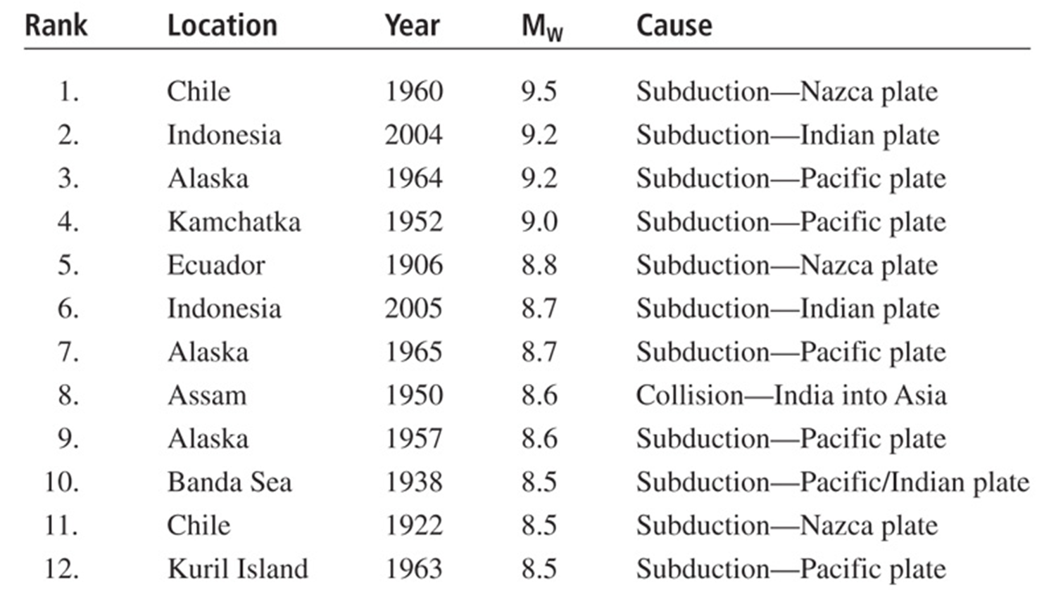
Largest Earthquakes Since 1900 - note that all of these earthquakes occur on convergent plate boundaries, and most are on a subduction zone.

Global Earthquake Hazards
 |
||
| Map showing global earthquake risk. Colored areas correspond with plate boundaries (mostly convergent), with green representing lowest risk and red the highest. Image from: GLOBAL SEISMIC HAZARD ASSESSMENT PROGRAM | ||
 |
||
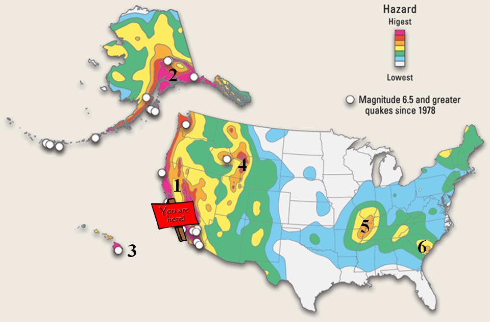
The USGS National Seismic Hazard Map shows where in the US the greatest risk of earthquakes are found.
|
||
Historic California Earthquakes (+7 M) |
||
1857 –Fort Tejon (8.25)
|
 image from: http://scedc.caltech.edu/significant/index.html |
|