Floods: The Worst Geological Hazard
They are the most costly in terms of life, property, and land. Furthermore, they can occur almost anywhere.
- Damage is caused by:
- Erosion by flood waters
- Impact of water on structures
- Sediment deposition
- Contamination of surface waters
- Loss of life
Urbanization and Erosion
Both natural and urban landscapes have low erosion rates. However, construction as natural lands are urbanized causes high erosion rates. Factors which have increased erosion include:
- Deforestation – results in increased erosion
- Overgrazing – also increased erosion
- Urbanization – More rapid discharge to streams. This results in more frequent floods and higher flood peaks. Urban runoff is highly toxic and contaminates everything it saturates.
100-year Floods and Recurrence Intervals
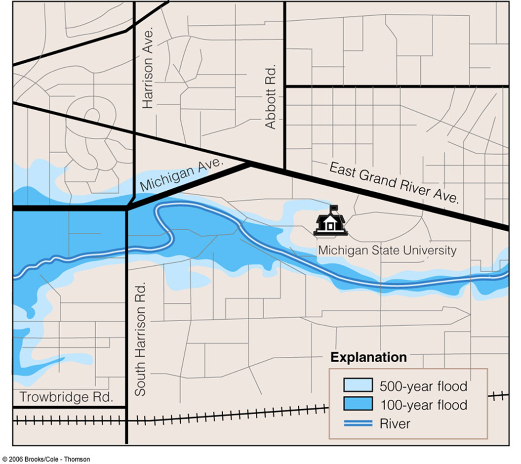
Because floodplains are such fertile grounds, farms and towns have been built on them. Urban areas have also developed along rivers due to commerce potential as well. This puts millions of people at risk of flooding each year. The U.S. Federal Emergency Management Agency (FEMA) creates National Flood Insurance flood hazard maps for communities at risk of flooding. Homes and businesses located within these FEMA flood zones are required to have flood insurance.
Let's look at Bellevue, Washington. Prior to 1977, the streamflow needed for a flood to be considered a 100-year flood on Mercer Creek was 400 cf/s. There was a population boom in the area in 1977, and the increased urban area has resulted in an increase in runoff into Mercer Creek. A 100-year flood is now one with nearly 1,000 cf/s streamflow.

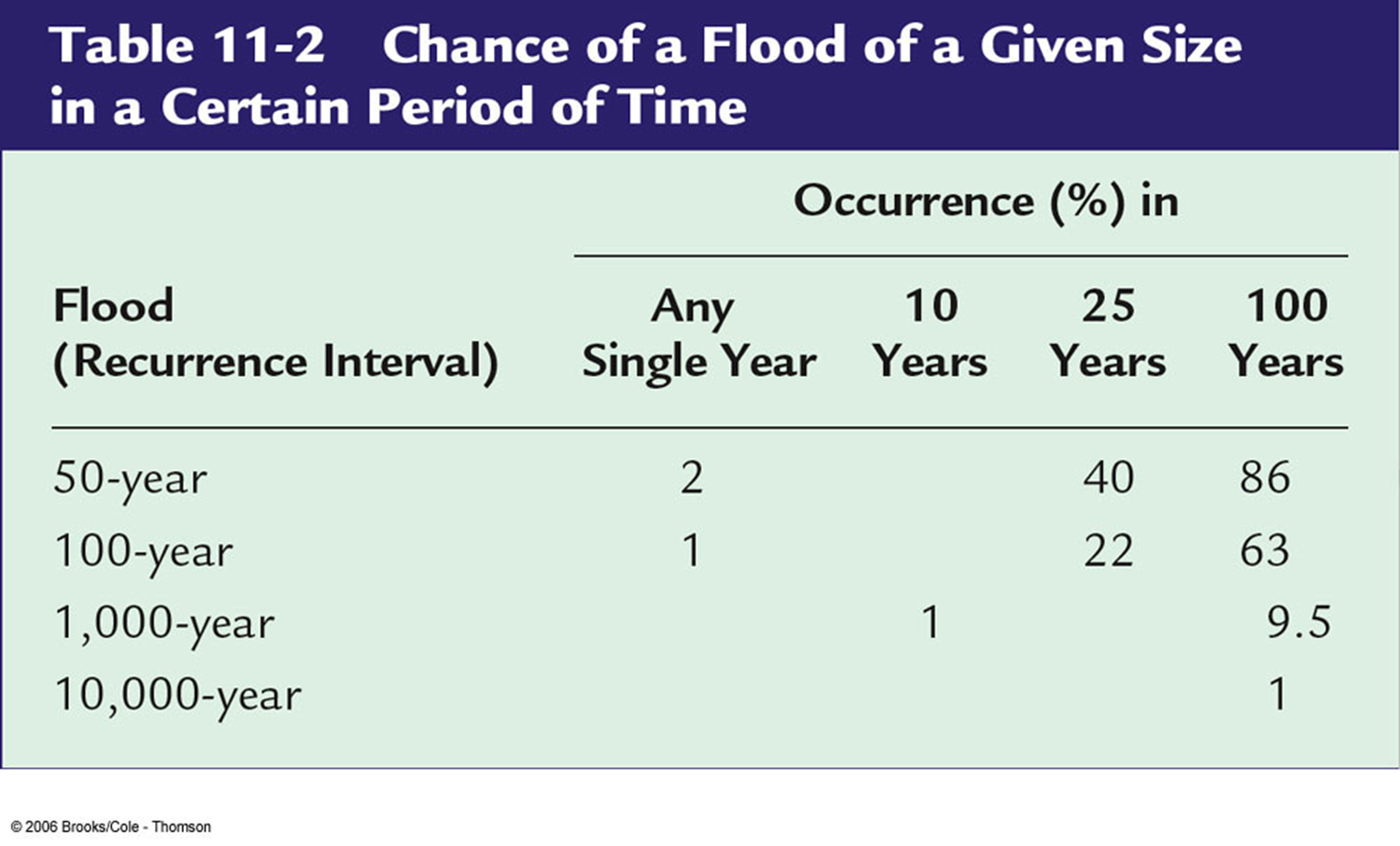
The average recurrence interval between major storms or floods is easily calculated. Is based on the probability that the flow will be equaled or exceeded in any given year. Example: there is 1 in 100 chance that a peak flow of a certain amount (say, 30,000 cf/s) can occur on a river. Thus, that river is said to have a 100-year interval.
Engineers design for particular recurrence intervals:
- Streets: 2-5 years
- Debris dams: 5 - 25 years
- Upper valley dams: 100 years
- Levees: 100 yrs
- Large dams: 1000+ years

Problems! Stream flood data must cover a long enough time frame. Scientists use paleoflood data to help fill in the gaps. Additionally, conditions affecting stream flow upstream must be similar throughout time - which is not always the case.
<< back |
||
