
Beaches and Coastlines
Beach Processes
The beach is a buffer zone protecting the onshore area. It is also in equilibrium - that is, the amount of material brought in = the amount of material removed. Most beaches are typically wide in the summer and narrow in the winter, and storms can induce major changes. At any point in time, a beach may be:
- Growing
- Stable
- Eroding
Sediment Transport
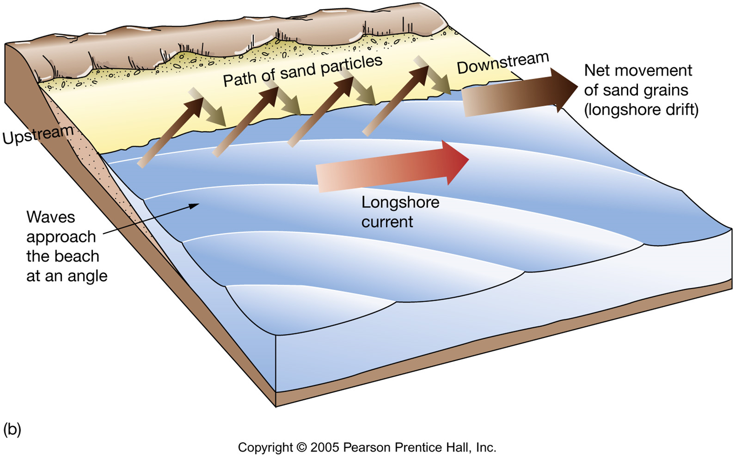
Swash - as waves crash and rush onto the shore, the not only move water but a little bit of sediment onto the beach. The movement it perpendicular to shoreline (toward and away).
Backwash - Then the water pulls back away from the shore, moving water and a little bit of sediment off of the beach. The movement is parallel to shoreline (up-coast or down-coast)
During periods of light wave activity the swash dominates. Sediment is moved toward shore, creating a wider beach. Light wave activity is associated with fair weather and is called a “Summertime” beach. During times of heavy wave activity the backwash dominates. Sediment is moved away from shore, creating a narrower beach. The sediment is forms offshore sand bars where it is stored until the summer. Heavy wave activity is associated with stormy weather and is referred to as a “Wintertime” beach.
This zig-zag motion of sediment via the swash/backwash is called Longshore (or beach) Drift.
The Longshore Current moves down beach and is caused by waves hitting beach at angle. This current flows parallel to the shore and transports sediments down the coast. The longshore current moves substantially more sediment than does the longshore drift. How much? Around 150,000 to 300,000 m3/yr on the Atlantic seaboard and 750,000 m3/yr offshore Oxnard, California.
Longshore drift is often interrupted by jetties, groins and breakwaters. This causes an undesirable build up of sand in areas where there shouldn't be.
Together, the longshore drift and current transport sediment along a coastline until it reaches a submarine canyon. All of the sediment gets funneled down the canyons and onto the deep sea floor. Then the process starts up again just down shore from the canyon. Sections of coast in which sand input and sand output are balanced are referred to as coastal cells.
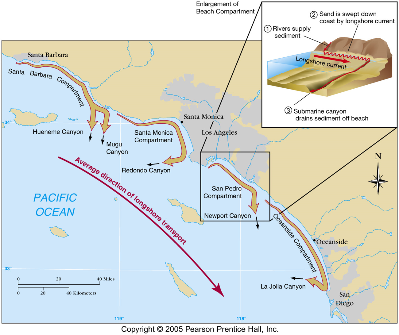
Sediment is "lost" into submarine canyons. Fans at canyon mouths are proof of sand loss down canyons. Different canyons remove sediments at different rate, but the amount of sediment being removed by La Jolla canyon just north of San Diego is enormous: 150,000 m3/yr.
Another way for a beach to loose sand is through rip currents. Rip currents or other strong currents carry sand offshore into deep water. Look for any of these clues to identify rip current:
- a channel of churning, choppy water
- an area having a notable difference in water color
- a line of foam, seaweed, or debris moving steadily seaward
- a break in the incoming wave pattern
<< back |
||