Southern California Coastal Wetlands
Ballona Wetlands6799 Culver Place, Playa del Rey, CA 90293; http://www.ballonafriends.org/index.html
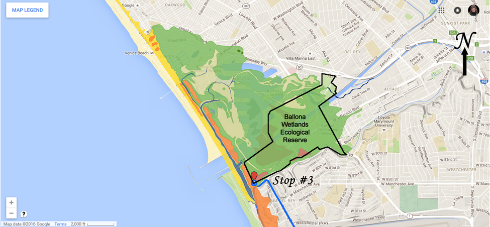
Google Earth Map Showing The Location Of Stop #3, Ballona Wetlands Ecological Reserve, Showing The Extent Of Historical Wetlands. The early history of the Ballona wetlands area is similar to the Huntington Beach and Bosla Chica wetlands. In 1820, a mestizo rancher named Augustine Machado received a land grant from Mexico for 14,000 acres in the Ballona area. Much of the Rancho de Ballona was used for cattle grazing – and wetlands are not suitable for cattle. Like much of the Los Angeles / Orange County areas, everything changed in the early 1920s due to the popularity of the automobile and the discovery of oil in the region. The Army Corps of Engineers dredged much of the wetland areas and cemented the banks as a part of the Los Angeles County flood control program. It was not until 1960s when 900+ acres of wetlands were destroyed to create Marina Del Rey. The wetlands continued to be threatened up into the 1990s, until the land was saved by conservationist. Since then, most of the wetlands have been restored. Wetlands today are typically classified based upon hydrology: estuarine, freshwater, seasonally flooded, riparian, or upland. The lands from the coast to Culver Blvd and south of Ballona Creek are classified as a saltwater or estuarine marsh. These areas are under the influence from saltwater from the Pacific Ocean in addition to freshwater runoff from Ballona Creek and the surrounding urban areas, and the flora and fauna that inhabit these areas are adapted to both salt and fresh water conditions. North of this area is the freshwater marsh and riparian habitats. |
