Southern California Tectonics |
|
The geomorphology of the Southern California region is dominated by numerous faults, all of which are dominated by the San Andreas Fault Zone. The San Gabriel Mountains tower nearly 9,000 feet above the floor of the San Gabriel Valley. The San Gabriel Mountains are a part of an east-west trending series of mountains called the Transverse Ranges (see Figure 2) that extend from Santa Barbara to Joshua Tree National Park and separate the San Fernando, San Gabriel (Carena & Suppe, 2002) and San Bernardino Valleys in the south from the Mojave Desert and Soledad Basin to the north. The rocks of the San Gabriel Mountains are a complex terrain of igneous and metamorphic rocks that range in age from Precambrian to Cenozoic. The geology is quite complex and most professional geologists have a hard time determining what is where. The rocks that comprise the Mendenhall gneiss are the oldest in the San Gabriels, having been metamorphosed around 1670 million years ago. About 1,220 m.y. ago the San Gabriel anorthosite intruded into the Mendenhall gneiss. Other igneous rocks in the San Gabriel Mountains include the Mesozoic Mt. Lowe granodiorite, the 80-90 m.y. old Wilson diorite, and the 80 m.y. old Mt. Josephine granodiorite. The San Gabriel Mountains are bound on the north by the San Andreas Fault Zone and on the south by the Sierra Madre Fault. Recent uplift of the mountains by these faults has caused the topography to be very rugged and deeply dissected. Steep canyons are up to 3,000 feet deep while peaks range from 7,000 to 9,000 feet in elevation. The south side of the San Gabriels appears to be steeper and more dramatic than the north side; this is due to a difference in elevation between the Los Angeles basin (sea level to ~400 feet) and the Mojave Desert (~4,000 feet). |
|
 |
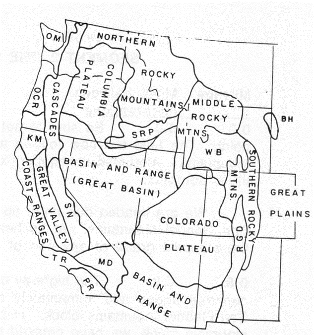
Physiographic provinces of the western United States. OM, Olympic Mountains; OCR, Oregon Coast Range; KM, Klamath Mountains; TR, Transverse Ranges; SN, Sierra Nevada; MD, Mojave Desert; PR, Peninsular Ranges; SRP, Snake River Plain; WB, Wasatch Basin |
 |
|
| Map of a portion of the Southern California Region, Transverse Ranges, showing the location of major faults and the epicenters of major earthquakes. Bold line represent tectonic ruptures associated with those historic earthquakes. Arrows represent relative motion of the fault, and faults with barbs represent reverse faults, with the barbs on the upper fault block. By S. Leyva, Modified from (Yerkes, Bonilla, Youd ,and Sims, 1974) | |