Stop #1: San Gabriel Mountains and Faults Overlook |
||||
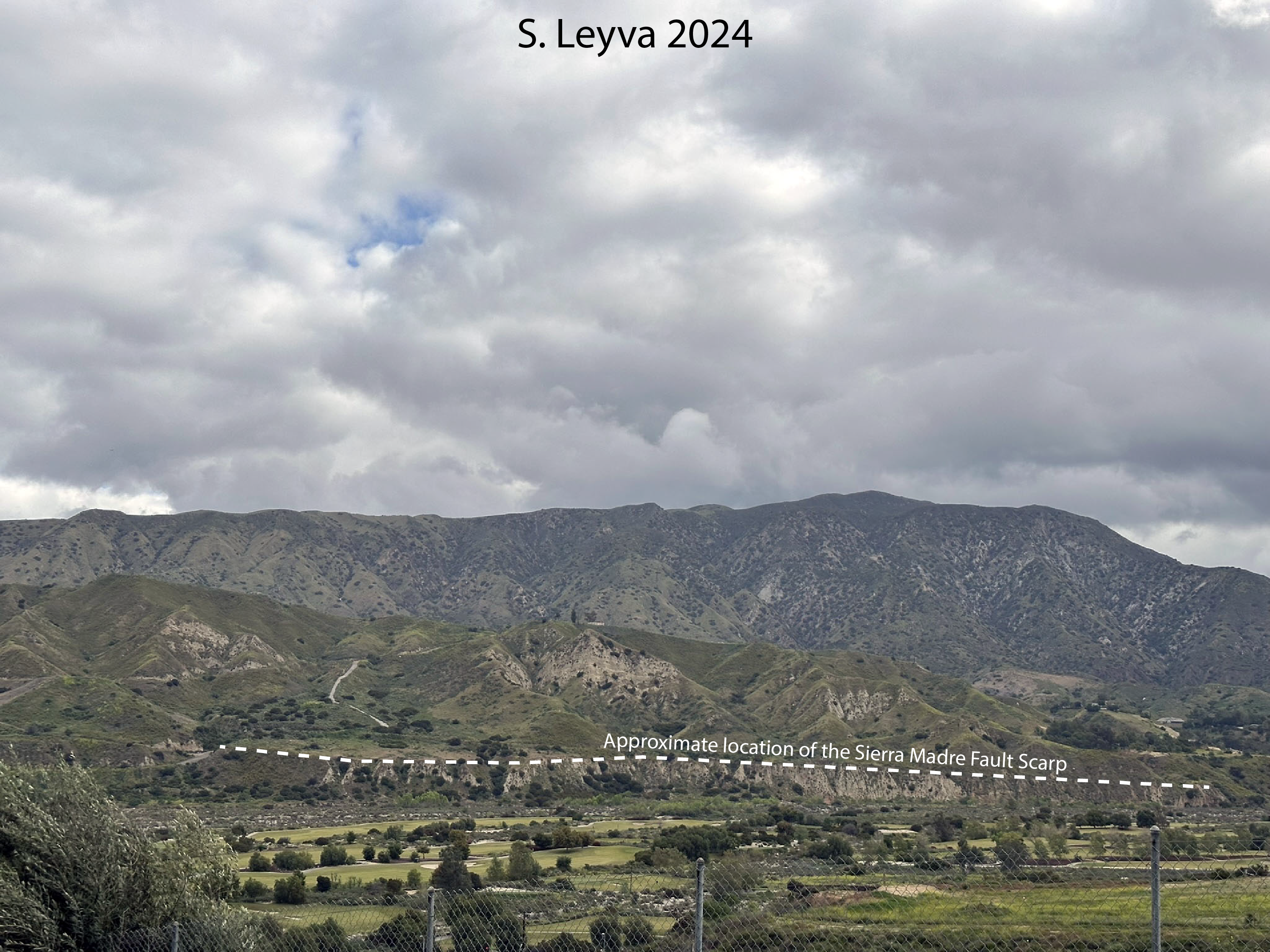
This quiet street is a good place to get a view of the western San Gabriel Mountains. At the base of the mountains are a series of thrust faults, including the Sierra Madre Fault and it's associated faults, the Lakeview Fault Zone and the Sunland Fault. These faults are a part of a larger group of thrust faults that are uplifting the San Gabriel Mountains and downdropping the San Gabriel and San Fernando Valleys. Below is an image looking north towards the San Gabriel Mountains. The Tujunga wash is in the foreground, just beyond the fence. Rising above the wash is a bluff comprised of light-colored rocks. The Sierra Madre Fault is a reverse fault, meaning that the hanging wall portion of the fault moves up relative to the footwall side. In the case of the Sierra Madre Fault, the northern side (further from the viewer in the image below) is moving up relative to the southern side (where the Tujunga Wash lies), producing the pale beige colored rocks exposed along the northern side of the wash (also see the cross section from Rollins et al. (2018) below).
On the other side of the mountains from here is the epicenter of the 1971 Sylmar Earthquake. The city of Sylmar is to the northwest of here, and the earthquake got it's name from all of the damage it caused to the city and neighboring communities. Faults are common throughout the Southern California area, with thrust faults the most common at the bases of the Santa Monica, San Gabriel, and San Bernardino Mountains. When rupturing, the energy is directional - meaning that, instead of being released somewhat evenly from the epicenter, it is focused in one directions (say, to the north). Earthquakes along thrust faults produces an odd pattern of destruction: high amounts in the direction of thrust, and low on the other side of the fault. Review the shakemaps for two Southern California earthquakes that happened within five years of each other. The stars represent the epicenter of the earthquake, and the colored areas represent earthquake intensity - how strongly the ground shook, with red being the most intense and blue the least. For the Northridge Earthquake (left image), the red area is to the north of the epicenter; for the Hector Mine Earthquake (right image), the pattern is like a bull's eye, with the epicenter in the center. The difference in the pattern is due to the type of fault involved. The Northridge Earthquake was on a blind thrust (the Northridge thrust), and the direction of the energy released was to the north. The Hector Mine Earthquake was on two faults, the the Lavic Lake fault and the central section of the Bullion fault, both right-lateral strike-slip faults, and the energy released in this earthquake was mostly on either side of the faults.
Thrust faulting in the Southern California area is common. The Sierra Madre Fault, in association with several other thrust and reverse faults, are the result of compression caused by the "bend" in the San Andreas Fault Zone (see Introduction). Below is a cross section of the LA Basin and San Gabriel Mountains (simplified from from Rollins et al. (2018)). Note how the Sierra Madre Fault is pushing the mountains up, and the San Gabriel Valley down.
This image (Rollins et al. (2018)) shows the results of recent studies of the interaction of thrust faults in the Los Angeles area. The dark blue arrows on the map show motion as recorded by GPS sensors, and they indicate that the Los Angeles Basin is shortening. This is likely due to the mountains thrusting over the basin. In short, we live in earthquake country. Are you prepared?
|


